|
Virtual Scan Pro |
Virtual Scan Lite |
Field Scan ROBO |
| Application |
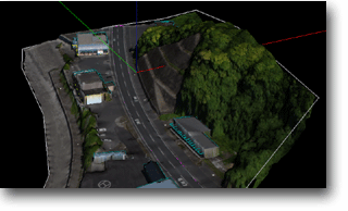
3D Measurement and DSM Modelling |
3D Measurement and DSM Modelling |
3D Measurement and DSM Modelling |
|
Recommended for wide area modelling |
Recommended for wide area modelling |
Recommended for local area modelling |
| Method to measure |
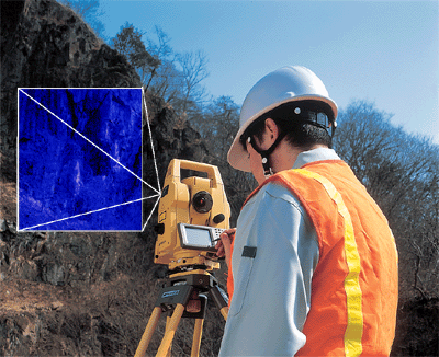
Digital Image Processing |
Digital Image Processing |
Distance/Angle Measurement |
| Field Work Time (relatively) |
Very fast |
Fast |
Normal |
| In-Office processing time |
Normal |
Fast |
Very Fast (Not required) |
| Measurement Range |
250m |
250m |
120m (Normal Mode) |
|
(3000m : 1Prism) |
(3000m : 1Prism) |
30-1200m (Long Mode) |
| Accuracy |
Plain(counterview) : dXY=H/f x dP |
Plain(counterview) : dXY=H/f x dP |
+/-(3mm+2ppm)m.s.e. (Normal Mode) |
|
Depth(perspective): dZ=H/B x dXY |
Depth(perspective): dZ=H/B x dXY |
+/-(10mm+10ppm)m.s.e.(Long mode) |
|
(H:Photographing Distance, f:Focul distance,dp:Image Resolution, B:Baseline Length) |
| Use as survey/construction total station |
Possible |
Possible |
Possible |
|
|
|
| Bundle PC Software |
|
|
|
|
PI-3000 |
PI-3000 Lite |
DI-3000 |
|
(with Built-in Camera Calibration S/W) |
(Upgradable to PI-3000) |
(Upgradable to PI-3000/PI-3000Lite) |
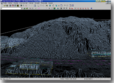
| DSM Auto Measurement |
Possible |
Possible |
No (Load/Display/Edit only) |
| Texture Mapping (DSM with Texture) |
Possible |
Possible |
Possible |
| Ortho-Image |
Possible |
Possible |
Possible |
| Calculation |
Distance/Area/Contour/Cross Section/Volume |
Distance/Area/Contour/Cross Section/Volume |
Distance/Area/Contour/Cross Section/Volume |
| Data Export |
Point Data : CSV/DXF |
Point Data : CSV/DXF |
Point Data : CSV/DXF |
|
Ortho : World file format |
Ortho : World file format |
Ortho : World file format |
|
3D Model : VRML |
3D Model : VRML |
3D Model : VRML |
|
|
|
| Standard Bundle Component |
|
|
|
|
GPT-7000i |
GPT-7000i |
GPT-8200A |
|
Field Orientation Software |
PI-3000Lite with Field Orientation S/W |
FC-100 |
|
PI-3000 |
|
Field Scan Software for FC-100 |
|
External Digital Camera (Optional) |
|
DI-3000 |